Now that the weather has finally settled down, at the beginning of each week, I will attempt to post an outlook of significant weather for the upcoming week.
On Friday, I’ll provide an update for the weekend. I’ll also continue with regular tweets and post special interest weather stories.
The rather quiet weather pattern we experienced over the weekend will continue this week. The first half of the week will provide some additional slow melt of the large snowpack; which continues to put stress on some structures, and is a flood risk should we get a heavy rain and/or warm spell.
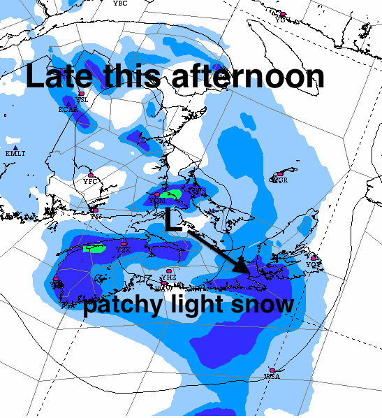
Today: A weak low pressure system will move across the region, touching off some patchy light snow this afternoon and evening. Some communities in the southern Maritime may see a few cm… enough to make the roads greasy for the drive home today.
Tuesday: A fine day for outdoor activities or travel.
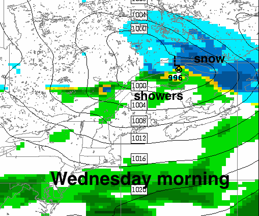
Wednesday: A low pressure system passing through Quebec will touch off some scattered showers. Brisk southwest winds will bring in mild air.
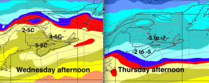
Thurs-Fri: Turning cold again… gusty northwest winds Thursday with some flurries, especially over the Annapolis Valley and Cape Breton Highlands.
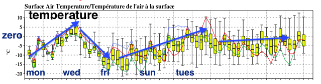
Temperatures
Weekend: possible snow system Saturday night into Sunday. Too early to be certain.
Stay safe