
After Hurricane Juan’s impacts on the Maritimes, the Canadian Hurricane Centre successfully proposed the retirement of the name. The Hurricane Committee considered replacement names, and chose the name: “Joachin”.
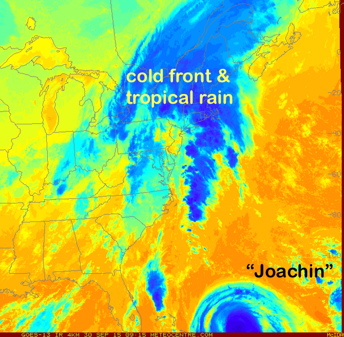
Almost 12 years to the date, Tropical Storm “Joachin” has formed and is located near the Bahamas, and is expected to soon become a Hurricane and eventually track toward the USA mid-Atlantic coast on the weekend bringing potential torrential rain and flooding.
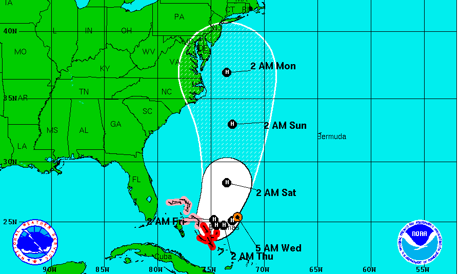 There is quite a bit of uncertainty as to the speed and track of this storm. However, a ridge of high pressure over Queebc on the weekend will keep a cool easterly flow that is likely to steer the storm with its wind and rain into the USA mid-Atlantic states. This could change… and this storm will make the news.
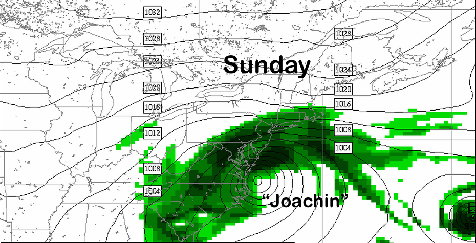
While we may not feel the direct impacts from Joachin, the tropical moisture ahead of the system is impacting us, as a cold front squeezes heavy rain as it passes south today and stalls Thursday and Friday over Nova Scotia.
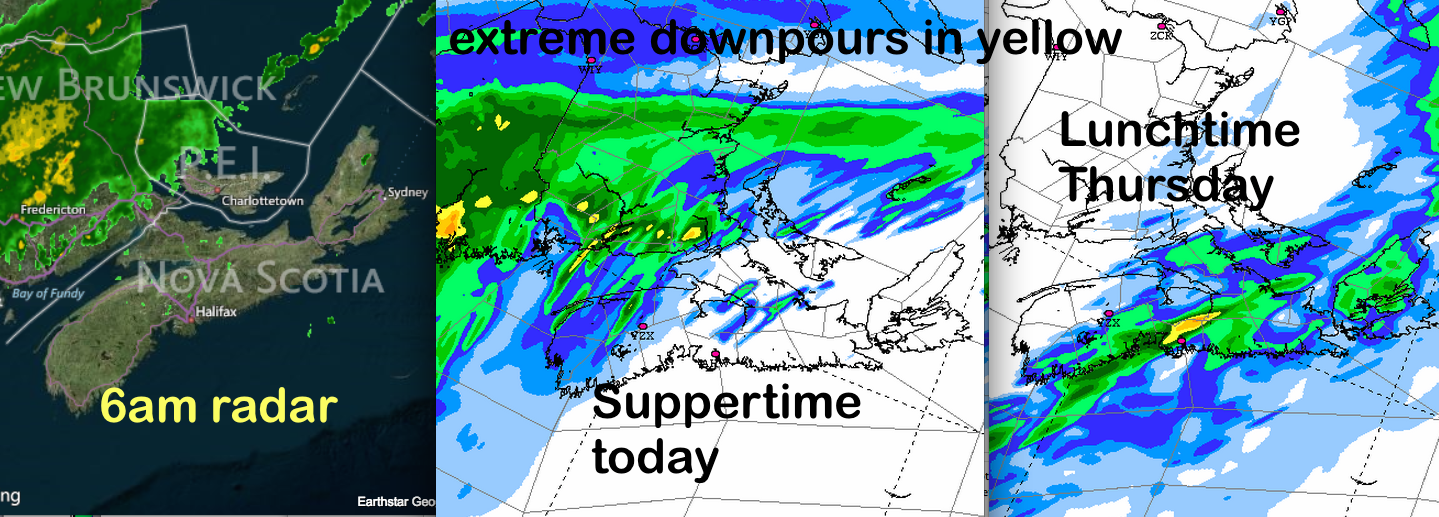
There is consensus that total rainfalls will exceed 100mm (and may even total 200mm in some areas of New Brunswick), and Environment Canada has issued warnings and special weather statements for the Maritimes.
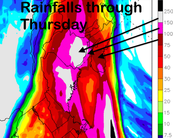
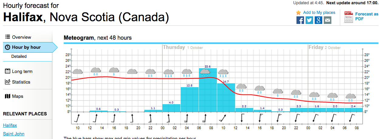
There are definite flood risks with these rainfalls, not only with the high totals, but also with the intensity of the downpours with this system. Rain rates of 10 to 20mm per hour will occur at times with this system, challenging storm sewers to keep up (Thursday morning in Halifax in the graphic below), causing flash flooding and making driving very hazardous.
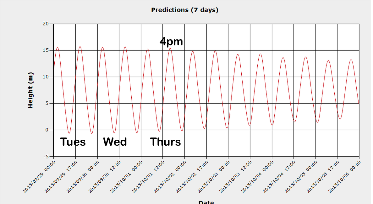
Finally, the high tides from our recent supermoon may also contribute to flooding in tidal rivers. For example, the combination of a very high tide in Truro late Thursday afternoon with heavy rain on the Salmon and North Rivers may enhance the flood threat.
Prepare for this rainfall by clearing storm drains and eaves troughs, remove valuables from basements, and limit driving (and speed).
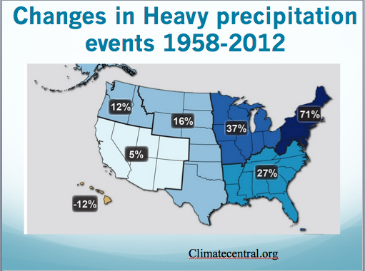
This summer, much of our rainfall events have been in the form of very heavy downpours. This is consistent with expectations of climate change, where a warmer atmosphere contains more moisture, contributing to more intense storms and heavier downpours that challenge our infrastructure. This is already happening in New England (and here), and I expect the trend will only get worse.
Stay safe and keep an eye on the updated forecasts and the track of “Joachin” and its leftovers.
