Now that our weather is more summer like, the precipitation is often forecast in the form of showers. However, forecasts of showers are seldom specific. For example, on Sunday the forecast for Halifax was 60% chance of showers; while Fredericton was periods of rain.
The radar in the morning showed some spotty showers approaching Halifax, and quite a bit of rain over Fredericton. Halifax had one shower just after 8am, then it was damp much of the afternoon. Fredericton was damp all morning, but the rain tapered off in the afternoon. Activities can be planned around these forecasts by consulting the radar.
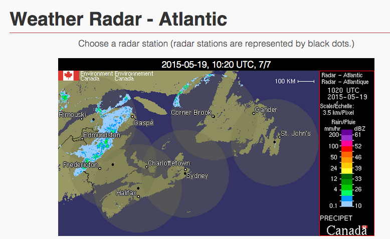
Environment Canada has three radars located in the Maritimes: the Halifax Radar is over high ground near Gore; the New Brunswick Radar is in Mechanic Settlement, and the Cape Breton Radar is in Marion Bridge.
The radar displayed in the above image is from Weather Underground. I like to use this, since it does a nice job integrating the three Maritime radars, and includes input from the US radars in Maine, such as the Caribou radar
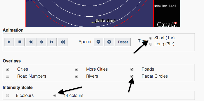
The Environment Canada radar site has a few options for viewing (such as roads of rivers). I prefer to have the 40km rings turned on to assist in timing. The short (1hr animation) is in 10 minute intervals, the 3hr animation is in 20 minute intervals. If a feature moves over two rings in once hour, it is advancing at 80km/h! I also prefer to look at all 14 colours. The brighter colours are often heavy rain, and may indicate a thunderstorm.
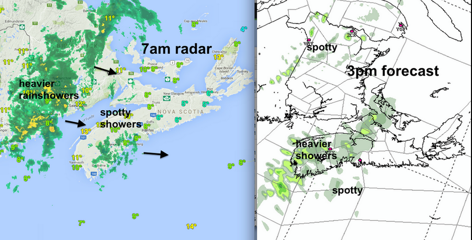
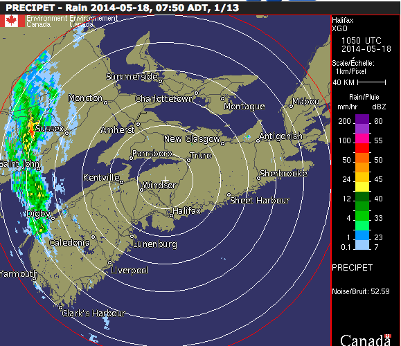
It is important to animate the radar to get a feeling for how fast precipitation is moving. In the example below, a nearly Stationary system is giving Saint John and Fredericton heavy rain, with Moncton and Halifax getting nothing. Environment Canada has a nice summary on how to use the radar.
In the above example, the weak blue echoes on radar may indicate quite a bit of drizzle over the South Shore of Nova Scotia. Drizzle is not well detected by radar. Also, since the radar beam is sent in a straight line, and the Earth’s surface is curved, the beam over the South Shore is 2-3km above the surface. Most of the drizzle is below that level.
Similarly, sometimes rain falling from clouds evaporates before hitting the ground. The radar may see this rain at a distance; but it’s not actually reaching the surface.
It’s not easy to determine where fast Moving cells will hit, since they change shape and sometimes disappear as they move east. In this example Downtown Halifax only had a light sprinkle, while heavy rain hit the suburbs to the north.
n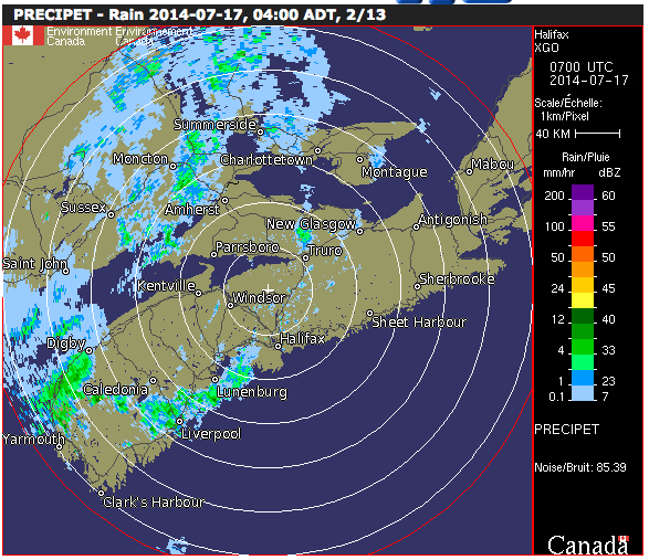
There are a number of other potential radar interpretation challenges. On clear mornings, the radar beam may be bent by the atmosphere, and strike the ground. If you see echoes clustered along the coastlines that are not moving, they may not be real, but an Anomalous Propogation of the radar beam.
Some of these interpretation errors are described by Environment Canada: http: //www.ec.gc.ca/meteo-weather/default.asp?lang=En&n=2B931828-1#Common_interpretation_errors
It is also helpful to check for dangerous lightning by opening the Lightning Danger Map. If you are outside and hear thunder, the safest location is indoors. Head inside immediately.
I’ll share another note on radar later this year with hints on radar use in the winter.
Stay Safe