It’s important for meteorologists to convey the level of uncertainty in a forecast, so that decision-makers can assess the risk and prepare accordingly. In general, you can have more confidence on the short-term forecasts (for the first couple of days).
It is very rare for big storms to unexpectedly occur within 48hours of the forecast. The details, however, are always a challenge. For example, where and when a thunderstorm will strike, and how much rain it will produce, is a difficult to determine. In the winter, the rain-snow boundary, and total snowfalls, is also challenging… especially when a storm is approaching from the sea, where there is very little weather data. It is important to use weather radar and examine recent surface observations (including webcams) as a valuable strategy when making a weather-related decision when threatening weather is imminent..
For predictions of between 3 and 7 days, forecasters rely almost solely on the interpretation of computer weather simulations. Because computer models are slightly different, and because small errors in their starting point can grow over time, there is usually a range in the forecasts. This range is very useful; since a narrow range may allow you to have more confidence in the forecast. Even a broad spread of options allows you to consider a number of possibilities before making a decision. So, while official forecasts do give a specific values for temperature (or precipitation amounts in some cases) for 3 to 7 days ahead, you should expect that these will change as the forecasts become more certain in the day or two before the event.
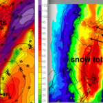
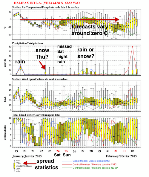
I do like to examine and make reference to charts produced by an “ensemble” of weather models. A recent example of the North American Ensemble Forecast is appended to this article (click on the image to view it in detail). This product provides the meteorologists and the public with a statistical range of expected temperature, precipitation, wind speed, and cloud cover for a variety of communities in North America. It is produced twice a day: http://weather.gc.ca/ensemble/naefs/EPSgrams_e.html The ensemble of models issued Monday 19th January would have given Haligonians some certainty on the rainfall for that same afternoon. As well, there was some indication of the possibility of snow on Thursday that caused traffic hassles in Halifax. While the models predicted an event again the following Tuesday-Wednesday (27-28 January), they had very little indication of the big wind and rainstorm Saturday night, 24-25 January.
All to say that you should embrace uncertainty as part of your decision-making toolkit..