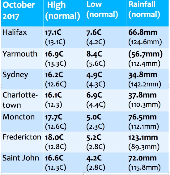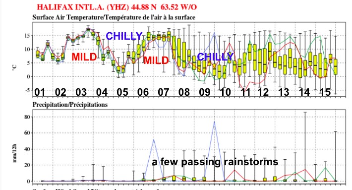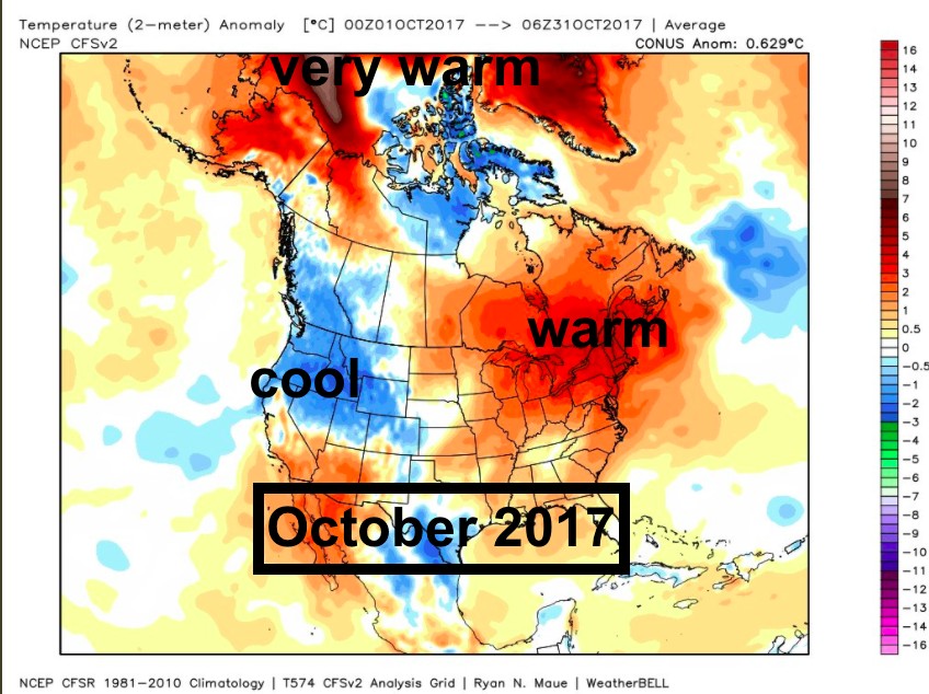
October was an amazingly warm month in the Maritimes, with high temperatures between 4 and 5C above normal. In most places it was also dry, in particular Prince Edward Island and Cape Breton. In fact Sydney received only about 25% of the normal rainfall. Recall that October 2016 had more than double the normal rainfall after the major rainstorm last Thanksgiving.
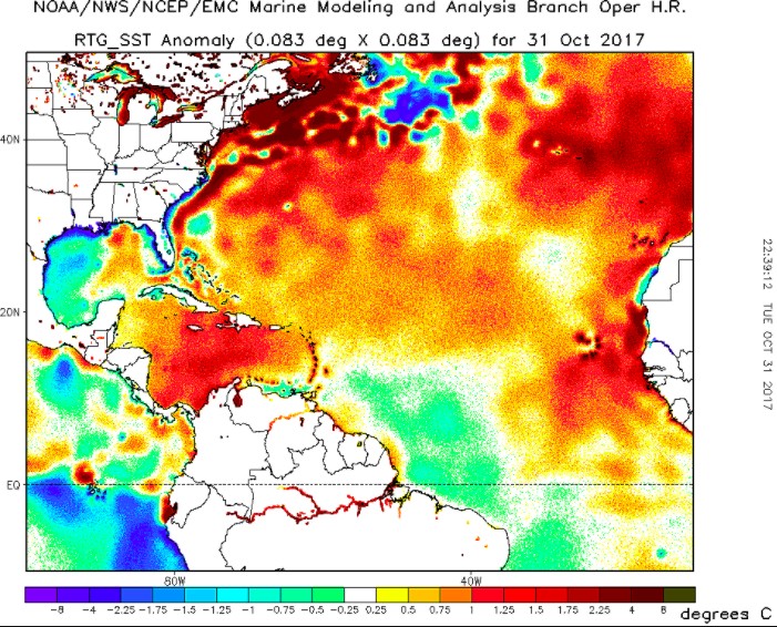
The very warm water temperatures surrounding the Maritimes are 3 to 5C above normal. This has certainly helped maintain our warm autumn, and it will take time for the ocean to cool.
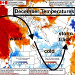
Now that we are in November, we are prone to cold air masses moving in from the continent to our west. This will result in quite a few swings in the temperatures as we begin the month. Later in the month, storms will become more likely. Consequently, we should have our vehicles prepared for winter anytime now, especially in New Brunswick, where snows typically arrive earlier.
The warm waters also fuel passing storms, so there is a risk of heavy precipitation events. The type of precipitation will depend on the storm track. However, the cold air behind storms will certainly present threat of heavy snowsqualls, especially over the Cape Breton Highlands in cold northwesterly flows off the warm Gulf of St. Lawrence.
Of course, I will remind everyone that this warm trend, while comfy for us all, is resulting in significant threats, as wildfires frequent the west, flood events are much more frequent, and sea levels are rising. All of the warmest years for the Earth have occurred in the past couple of decades… and we need to adapt to the threats associated with this new normal.
stay safe
Jim

