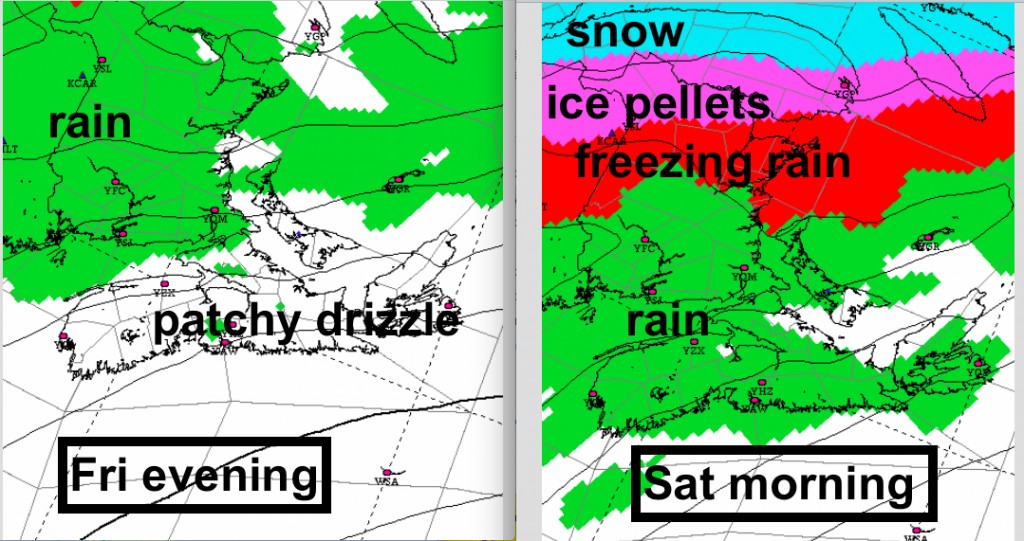
As temperatures turn mild today and Friday, wintry precipitation will not be in most people’s minds. However, Friday night, as rain spreads southwards across the Maritimes. a cold ridge of high pressure over Quebec will spread cold air over parts of the Maritimes.
Although it is Thursday, there is still big differences in the possible outcomes for Friday night and Saturday.
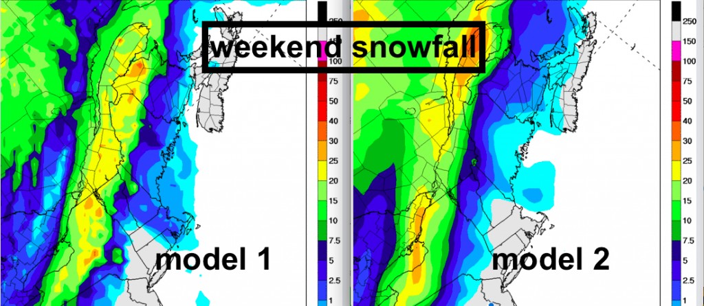
Snow: Heavy snow over the St. Lawrence Valley may affect only parts of Northern New Brunswick, or a great deal of that region (see pic). This snow, while likely impacting Montreal, is still uncertain for Toronto (which would impact air travel that goes through Toronto).
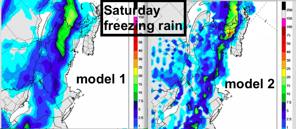
Further south, Freezing Rain is likely… but again the models are still not consistent in the forecast… since only a degree one way of the other… or a slight wind shift, will make the difference between rain, freezing rain, snow or ice pellets.
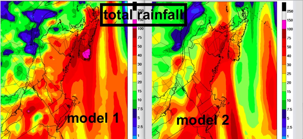
Over the southern Maritimes, some areas may get very heavy rain (50-100mm?). Even this forecast is uncertain.
So the best advice is to prepare for potentially heavy precipitation Friday night and Saturday. Heavy rain over the south will make driving tough and could lead to local flooding. Freezing rain is a hazard to air and road travel, as well as power outages. Heavy snow and ice pellets also impacts road and air travel.
Environment Canada has had Special Weather Statements… which express the uncertainty. As

