Friday’s storm is interesting and challenging; since it starts as a rather weak storm in the morning and is forecast to develop into a strong storm by evening. On Friday morning, winds will be light southeast and precipitation will be patchy and mixed. After lunch the precipitation becomes more organized and winds increase and back to the East-Northeast.
During the afternoon and evening the storm intensifies rather rapidly. The precipitation will become very organized and the winds will increase to strong northeast of 50 or 60km/h with coastal gusts likely to 90km/h in eastern NS which could cause power outages.

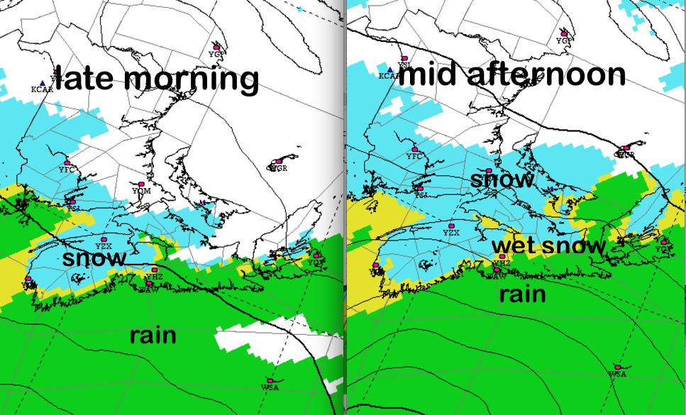
The shift in winds to Northeast and then to North late in the evening will result in the likely changeover to snow (with some ice pellets in the evening along the Canso-Fourchu area.
Snowfalls will depend largely on the timing and the rate of development of the storm. For Halifax, rain should start changing to wet snow after lunch and may be all snow by the drive home in late afternoon. If it changes to snow earlier, amounts will be on the higher range (25cm). If it doesn’t change until suppertime, amounts will be on the lighter range (10-15cm). Inland areas typically more likely to see the higher amounts.
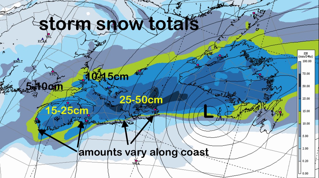
This snowfall chart is amongst the worst case scenario amongst the forecast models. Nevertheless, better for folks in all three provinces to be prepared for this potential storm, and limit travel in the afternoon and not plan on travelling in the evening.
I’ll tweet updates
Stay Safe
Jim