
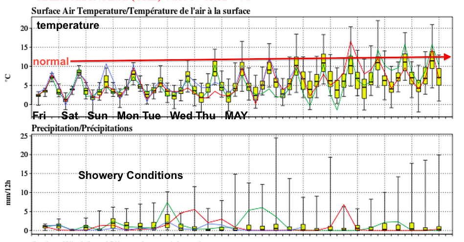
After a rough winter, the leftover snow on the ground reflects incoming sunshine. As well, the cold waters that surround us tend to result in the kind of April we are having.
This is pretty frustrating, but unfortunately typical (of course we typically benefit from the warm waters that surround us in the Fall and early winter).
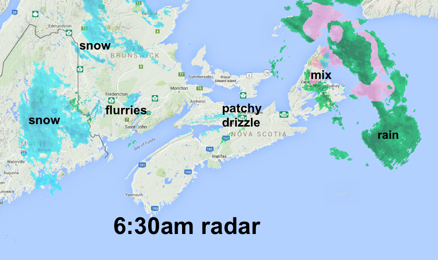
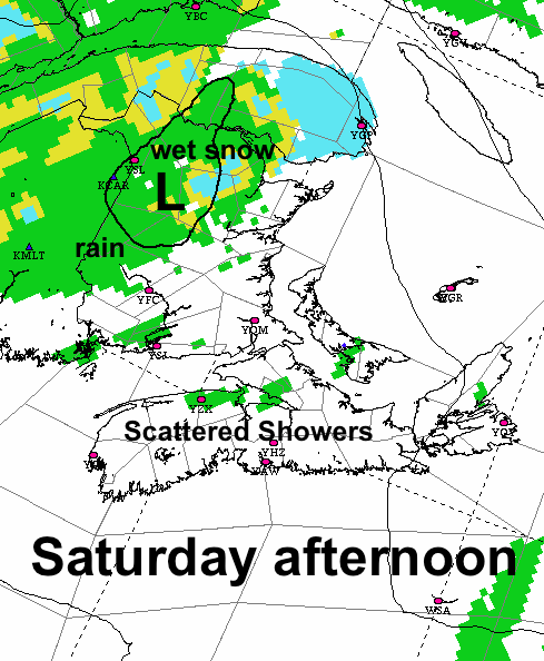
A nearly stationary low over the region today will keep most of the precipitation in central and northern New Brunswick and parts of Cape Breton. Elsewhere just scattered showers.
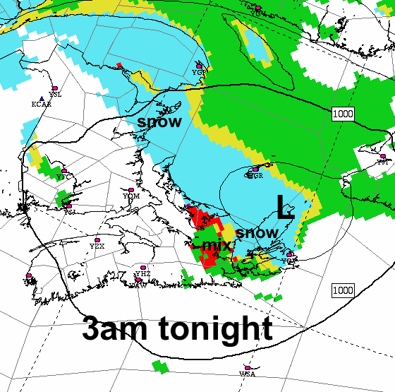
Tonight the band of snow over a line between Northeastern New Brunswick and Cape Breton will result in some accumulations. Don’t be surprised if some areas get 10cm, Prince Edward Island and the Strait area of Nova Scotia may or mat not “benefit” from this.
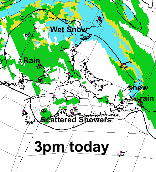
On Saturday, the low will be over Northern New Brunswick, so most of the rain or wet snow will remain there.
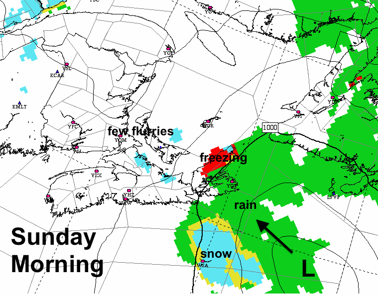
On Sunday new low will approach the Maritimes from the southeast. This will spread rain or wet snow slowly across the region. The southwestern sections of Nova Scotia and New Brunswick may be spared the precipitation from this feature.
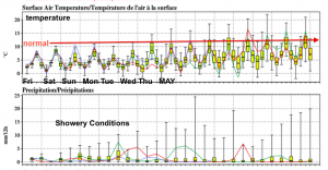
The ensemble of 40 models suggests that as we move into next week, this overall cool damp pattern will continue, with temperatures only gradually climbing to normal later in the week.

-150x150.jpg)
