
Follow us on Twitter – @haligonia or Facebook – http://facebook.com/haligonia for the latest info on Hurricane Irene's arrival in Halifax. This page will be updated as conditions merit.
08/28/11 4:00pm – Latest from Environment Canada:
Halifax Metro and Halifax County West
3:56 PM ADT Sunday 28 August 2011
Tropical storm warning for
Halifax Metro and Halifax County West continued
Strong southerly winds and showers at times heavy are expected tonight.
A tropical storm warning means that sustained gales…Winds of 63 km/h or more…Are expected in the specified areas within 24 hours. By nature a tropical storm also implies the threat of local flooding from heavy rainfall.
Tropical storm Irene is currently located over New England and is expected to become post-tropical before tracking through Extreme Northwestern New Brunswick Monday morning.
A tropical storm warning is in effect for western mainland Nova Scotia. Showers at time heavy will continue for most of the evening and through the night in Cape Breton. Thundershowers are also possible tonight. Currently an additional 10 to 30 millimeters of rain is forecast for tonight.
Also strong southerly winds gusting up to 100 km/h will begin this evening for mainland Nova Scotia. Les Suetes winds gusting up to 100 km/h are expected this evening for the Cape Breton Highlands.
Halifax Metro and Halifax County West
3:56 PM ADT Sunday 28 August 2011
Wind warning for
Halifax Metro and Halifax County West continued
Wind gusts up to 100 km/h expected tonight and Monday morning.
This is a warning that potentially damaging winds are expected in these regions. Monitor weather conditions..Listen for updated statements.
Tropical storm Irene is currently located over New England and is expected to become post-tropical before tracking through Extreme Northwestern New Brunswick Monday morning.
A tropical storm warning is in effect for western mainland Nova Scotia. Showers at time heavy will continue for most of the evening and through the night in Cape Breton. Thundershowers are also possible tonight. Currently an additional 10 to 30 millimeters of rain is forecast for tonight.
Also strong southerly winds gusting up to 100 km/h will begin this evening for mainland Nova Scotia. Les Suetes winds gusting up to 100 km/h are expected this evening for the Cape Breton Highlands.
08/28/11 12:50pm – EMO releases the following statement:
As tropical storm Irene works up the eastern seaboard, the Emergency Management Office asks Nova Scotians to use caution.
The large and powerful storm will affect the entire Atlantic region today, Aug. 28, and overnight into Monday.
"Let's all give this storm the respect it deserves," said Ross Landry, Minister of Justice. "Irene will bring heavy rain and high winds and the hazards those conditions can create. Please err on the side of caution."
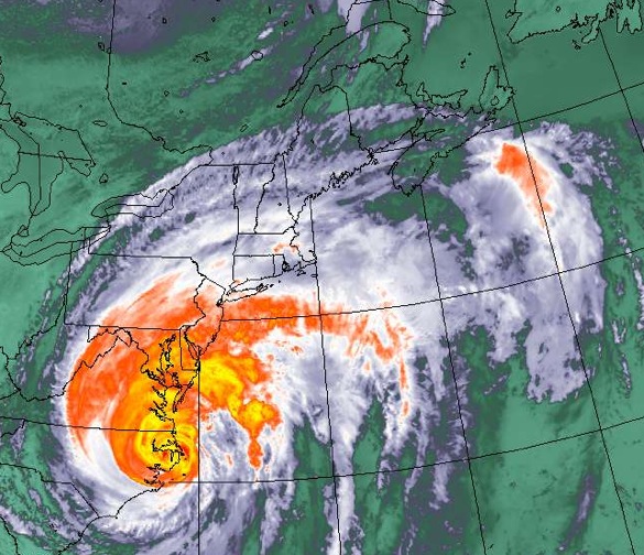
The eye of Irene is over New Jersey this morning with the storm stretching over New England. Tropical storm and winds warnings are in place for much of Nova Scotia and Atlantic Canada.
Storms of this kind can bring localized flooding, storm surge, dangerous coastal conditions and interruptions in essential services. Provincial parks on mainland Nova Scotia will close at noon today.
"I can not emphasize enough how important it is to keep a safe and reasonable distance from coastal areas," said Mr. Landry.
Nova Scotians should already have restocked emergency kits and be prepared to be self sufficient for up to three days. People should also review family emergency plans and secure property, ensuring anything that could become a projectile in high winds is put away or tied down.
As the storm gets closer today and overnight, it is recommended that people stay in their homes. People should not travel during the storm as flooding and debris can make road conditions unsafe. Thousands of flights on the eastern seaboard have been cancelled. Check arrivals and departures before going to the airport.
People should continue to monitor weather watches and warnings, and listen for updates and information on local radio stations. For updates and information on what to do before, during and after a major storm, visit www.gov.ns.ca/emo.
08/28/11 5:30am – Latest info from Environment Canada released:
Halifax Metro and Halifax County West
5:10 AM ADT Sunday 28 August 2011
Tropical storm warning for
Halifax Metro and Halifax County West continued
Strong southerly winds and heavy downpours are expected Sunday and Sunday night.
A tropical storm warning means that sustained gales…Winds of 63 km/h or more…Are expected in the specified areas within 24 hours. By nature a tropical storm also implies the threat of local flooding from heavy rainfall.
Hurricane Irene is currently located northeast of Wallops Island, Virginia and is expected to weaken and become post-tropical before tracking through Northwestern New Brunswick Monday morning.
A tropical storm warning is in effect for western mainland Nova Scotia. Showers across mainland Nova Scotia will become rain at times heavy through the day reaching Cape Breton by this afternoon. Currently 30 to 40 millimeters of rain is forecast. It is possible that rainfall warnings may be issued as Irene approaches.
Also strong southerly winds gusting up to 100 km/h will begin this evening for mainland Nova Scotia. Les Suetes winds gusting up to 100 km/h are expected this evening for the Cape Breton Highlands.
Halifax Metro and Halifax County West
5:10 AM ADT Sunday 28 August 2011
Wind warning for
Halifax Metro and Halifax County West continued
Wind gusts up to 100 km/h expected tonight.
This is a warning that potentially damaging winds are expected in these regions. Monitor weather conditions..Listen for updated statements.
Hurricane Irene is currently located northeast of Wallops Island, Virginia and is expected to weaken and become post-tropical before tracking through Northwestern New Brunswick Monday morning.
A tropical storm warning is in effect for western mainland Nova Scotia. Showers across mainland Nova Scotia will become rain at times heavy through the day reaching Cape Breton by this afternoon. Currently 30 to 40 millimeters of rain is forecast. It is possible that rainfall warnings may be issued as Irene approaches.
Also strong southerly winds gusting up to 100 km/h will begin this evening for mainland Nova Scotia. Les Suetes winds gusting up to 100 km/h are expected this evening for the Cape Breton Highlands.
