Ed note: Our most comprehensive details on Hurricane Lee are here our website. Some weather updates will be posted below. However, for the quickest and most up-to-date information from us, we recommend following our social media feeds. There’s a list at the bottom of this article.
Tropical Storm Warning 8:19 AM ADT Saturday 16 September 2023
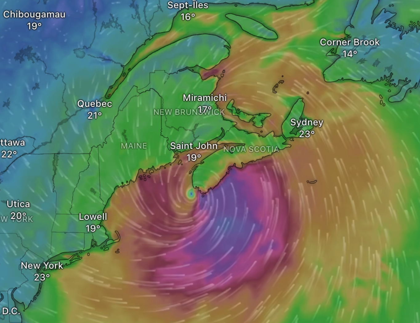
Tropical storm force winds of 70 gusting to 100 km/h over exposed areas from Post-tropical Storm Lee can be expected over the above regions. These conditions will spread across the region today with potentially higher gusts in the areas also under a Hurricane Watch (i.e. most of the southern half of mainland Nova Scotia). These winds will likely topple some trees (leading to downed utility lines), damage signs and cause some property damage to roofing materials, cladding, fences and exterior fixtures. This could result in some damage to docks and breakwaters. Shoreline erosion and wave overwash is expected where winds blow onshore. Secure loose objects on your property and anticipate power interruptions. By nature, a tropical storm also implies the threat of local flooding from heavy rainfall – consult your local area forecast for possible rainfall warnings. Please continue to monitor alerts issued by the Canadian Hurricane Centre and forecasts issued by Environment Canada. Reports of storm conditions and impacts can be emailed directly to NSstorm@ec.gc.ca or by tweeting reports by province using #NSStorm, #NBStorm, #PEStorm, #NLwx, #QCStorm or #ONStorm.
Wind Warning 8:27 AM ADT Saturday 16 September 2023
Strong winds that may cause damage are expected or occurring. Maximum gusts: 90 to 110 km/h. Locations: all of Nova Scotia. Time span: ending tonight from west to east. Damage to buildings, such as to roof shingles and windows, may occur. High winds may result in power outages and fallen tree branches. Wind warnings are issued when there is a significant risk of damaging winds. Please continue to monitor alerts and forecasts issued by Environment Canada. To report severe weather, send an email to NSstorm@ec.gc.ca or tweet reports using #NSStorm.
Storm Surge Warning 10:36 AM ADT Saturday 16 September 2023
People near the coast should monitor for worsening conditions and be prepared to move to a safer location at a moment’s notice. Impacts from storm surge are expected, including coastal flooding, beach erosion, infrastructure damage, spread of coastal debris, and localized coastal road washouts. Locations: Atlantic coast of mainland Nova Scotia, especially south-facing coastlines. Maximum Water Levels: exceeding high astronomical tide, with water inundating sections of the coast exposed to waves from the south. Maximum wave heights: 8 to 12 metres, breaking 4 to 6 metres for coastlines exposed to waves from the south. Time span: until tonight. Worst near high tides. The next high tide: 7 P.M. to 11 P.M. tonight. Remarks: Be sure to follow any instructions issued by local authorities. Storm surge warnings are issued when water levels pose a threat to coastal regions. Please continue to monitor alerts and forecasts issued by Environment Canada. To report severe weather, send an email to NSstorm@ec.gc.ca or tweet reports using #NSStorm.
Photos and video can be sent to info@haligonia.ca.
For those of you who are not social media users, remember, our feeds can be viewed without having an account.
Frequent updates:
Facebook
https://facebook.com/haligonia
X / Twitter
https://twitter.com/haligonia (Also don’t forget the #nsstorm hashtag, here)
Infrequent updates:
TikTok
https://tiktok.com/@haligonia
Instagram
https://instagram.com/haligonia.ca
Threads
https://threads.net/@haligonia.ca
Mastodon
https://mstdn.ca/@haligonia/