Last year, I posted an article regarding the importance of meteorologists in expressing uncertainty:(http://yhzweatherguy.ca/uncertainty-in-weather-forecasts/). Regardless of what decision you are making, it’s important to recognize the likelihood of one of several possibilities. You may want to plan for a worse case scenario, even if it is not the most likely event.
While there was quite a bit of uncertainty with the storm last Wednesday, the outcome was pretty close to the consensus forecast.
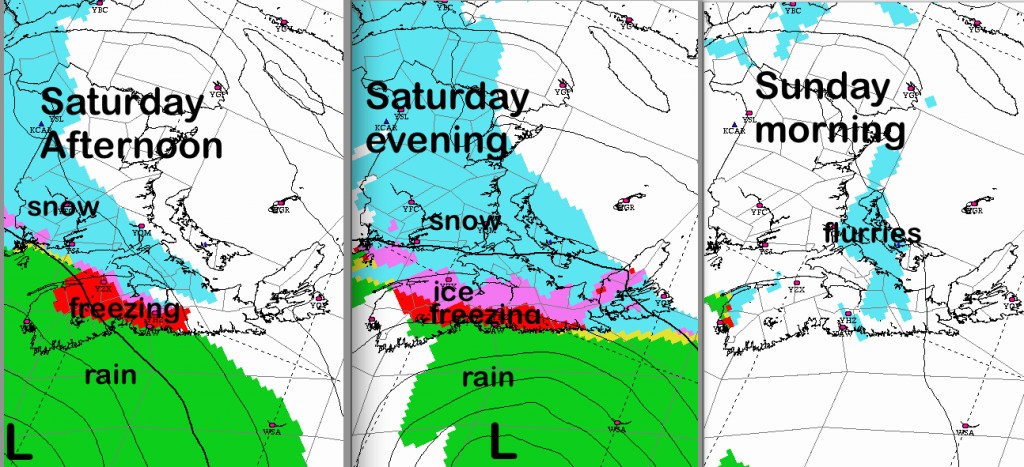
Saturday’s storm is even more difficult, largely due to the fact an old low over the St. Lawrence is weakening, and a new storm will be tracking across the ocean. The timing of the wind shift to Northeast ahead as the new low is critical. It also forms over the ocean which has much less data that contributes to a good forecast. Pretty tough forecast when only a 50-100km shift in the track of a storm (that is about a million square kilometres in size) is the difference between heavy rain and heavy snow.
The latest suite of weather models all agree on this broad story. There is no agreement on the details… in spite that all of these models are world-class. As I alluded to, the uncertainty is a result of the lack of data, and the big changes in precipitation due to slight change in wind direction.
Once the precipitation begins on Saturday, travel is not recommended until it tapers off overnight Saturday night. The strongest winds will be along the Atlantic Coast of Nova Scotia.. so power outages are a higher probability there, especially if there is freezing rain.
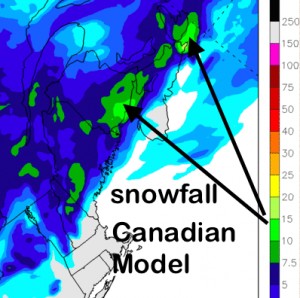
While the scenario above is very reasonable, it is different than other very good models. This one keeps snow through the centre of the Maritimes and mixed precipitation further south.
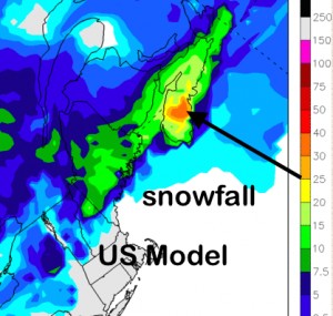
If we look at the US Model, it keeps the precipitation mostly as snow:
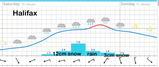
The European medium range has an outcome between these two. Meteograms from this model are available by searching for your own city: http://www.yr.no/place/Canada/Nova_Scotia/Halifax/hour_by_hour.html
You can therefore conclude that this uncertainty should result in folks maintaining a close watch and not letting down their guard. If the official forecast for your area is for manageable weather, do not relax and make plans. You should rather make contingencies, and prepare for possible severe weather.
Realizing there is uncertainty can be beneficial to your safety.
Once the storm begins, check radar, road conditions and webcams… along with forecast and warning updates from Environment Canada.
Stay Safe


