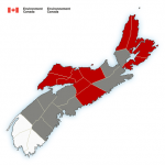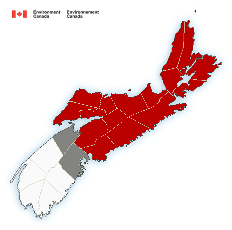
Snowfall warning for red areas.
Snowfall warning in effect for:
- Halifax Metro and Halifax County West
Snowfall, with total amounts of about 15 cm is expected.
A low pressure system will intensify as it approaches Nova Scotia tonight and Sunday. The low will move northeastward to lie over Cape Breton Sunday evening.
Wet snow is expected over portions of central and northern Nova Scotia on Sunday. Precipitation will likely start as rain overnight tonight or early Sunday morning. However, rain is forecast to change to wet snow as the low deepens and passes south of the province.
Significant snowfall accumulation up to 15 centimetres is expected to be limited to higher terrain.
Be prepared to adjust your driving with changing road conditions. Surfaces such as highways, roads, walkways and parking lots may become difficult to navigate due to accumulating snow.
Snowfall warnings are issued when significant snowfall is expected.
Please continue to monitor alerts and forecasts issued by Environment Canada. To report severe weather, send an email to ec.weatheraspc.ec@canada.ca or tweet reports to #NSStorm.
Statements
3:42 PM AST Saturday 26 November 2016
Special weather statement ended for:
- Halifax Metro and Halifax County Wes
For info on other counties, click here: https://weather.gc.ca/warnings/index_e.html?prov=ns
.
Source: Environment Canada