5:45 AM ADT Saturday 05 July 2014
Intermediate tropical cyclone information statement for:
NEW BRUNSWICK
NEWFOUNDLAND
NOVA SCOTIA
PRINCE EDWARD ISLAND
QUEBEC MARITIME
For post-tropical storm Arthur.
The next statement will be issued by 9:00 AM ADT.
This is the final statement by the chance of on this storm.
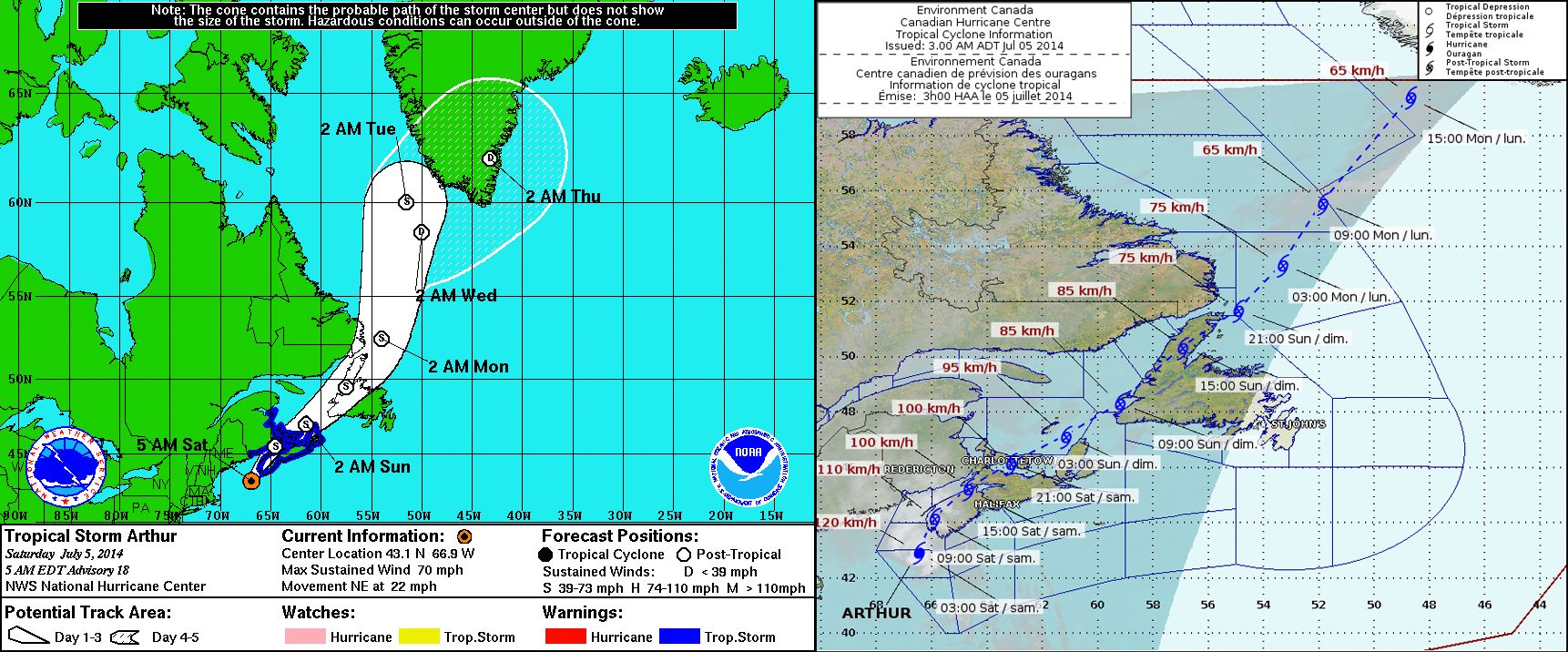
Heavy rain and strong winds spreading into Nova Scotia and New Brunswick.
1. Summary of basic information at 9.00 AM ADT.
Location: 43.3N 66.7W
About 60 kilometres southwest of Yarmouth
Maximum sustained winds: 110 km/hour
Present movement: northeast near 40 km/h
Minimum central pressure: 984 MB
2. Summary of latest information.
Arthur is now heading into Southwest Nova Scotia. Rain from a band to the north fed by Arthur and north of it has been bringing heavy rain into parts of New Brunswick. Rain directly caused by the storn is bring heavy rain and thundershowers into Southwest Nova Scotia. Increasing winds gusting to 90 km/h are hitting the coast south of Yarmouth. Further south buoy 44024 is recording winds gusting 100 km/h. There is also evidence from satellte data and surface observations of storm force winds west of Arthur.
At this point there is no change in the wind and rainfall forecast for the Maritimes. For Quebec, areas of heavy rainfall are expected for Gaspé and east as well as the basse cote nord area of Eastern Quebec and Anticosti Island. Newfoundland will be issueing rainfall warnings this morning for the Northern Peninsula and the straits region of Labrador
Flooding due to storm surge continues to look unlikely. For wave activity, the Atlantic coast of Nova Scotia will see between 5-7 metre waves along the southwestern shore Saturday morning and along the eastern shore in the afternoon and evening. Rough and pounding surf and rip currents are probable along much of the coast with these waves. Waves may reach 9 metres along the Scotian Slope.
Visit weatheroffice.Gc.Ca/hurricane (all in lower case) for the latest:
– forecast position, central pressure table.
– strength and predicted wind radii table.
– hurricane track information map.
– technical discussion.
Please also refer to the public and marine forecasts and warnings issued by Environment Canada for your area.


