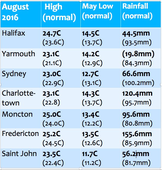
Summer in the Maritimes continued warmer than normal for most locations. While some heavy showers allowed much of New Brunswick (Saint John the exception) and Prince Edward Island to reach or exceed their normal rainfalls, Nova Scotia remained dry. In fact Southwestern sections of the province were much warmer than normal with rainfalls about 25 percent of normal; impacting crops, fire danger, and the availability of water in rivers and wells.
As we move into September, the long range forecasts continue to predict warmer than normal weather:
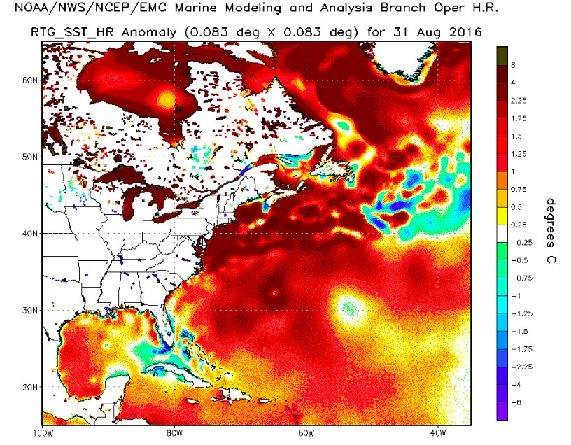
I am expecting precipitation numbers to recover in Nova Scotia in September. September is typically the busiest month for tropical cyclones. Furthermore, the sea surface temperatures surrounding the Maritimes are for the most part warmer than normal. Consequently, storms that reach our area may maintain more energy than otherwise.
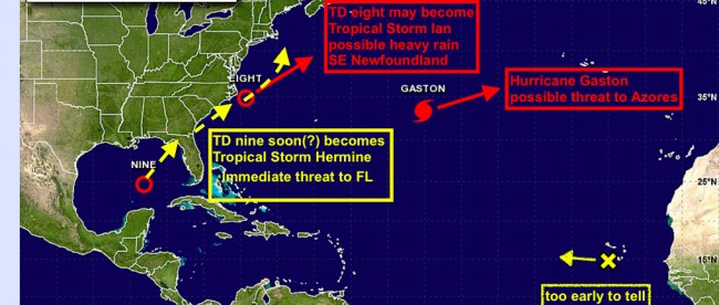
Yesterday, there were already a number of systems in the tropical Atlantic.
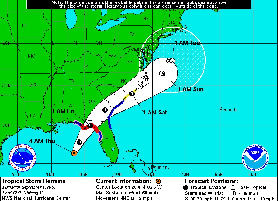
Indeed, Tropical Depression Nine did intensify yesterday afternoon to become Tropical Storm Hermine. While the immediate threat is for a potential hurricane for Florida, this storm is predicted to stall offshore of the mid Atlantic or New England coast next week. The precipitation and possibly strong winds from Hermine may eventually impact the Maritimes next week… with the dry southwestern sections of the Maritimes most likely to welcome some rain.
If Hermine does indeed stall, there will be plenty of time for folks in the Maritimes to prepare for any potential impacts.
Stay tuned and Stay Safe
Jim


