While most folks are still recovering from Sunday’s storm, there is more certainty that another significant storm will develop tonight.
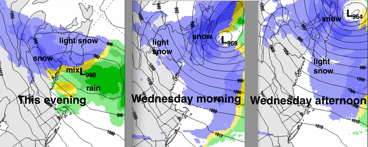
A Low pressure system moves into the Gulf of Maine tonight then intensifies as it passes south of Nova Scotia on Wednesday.
Light snow will begin over western sections of the Maritimes late this afternoon. Snow rates will intensify tonight and winds will increase to strong north or northeasterly, once again reducing visibilities to near zero, with significant blowing and drifting of the snow.
It does not appear that any mixed precipitation will be associated with this system… just snow.
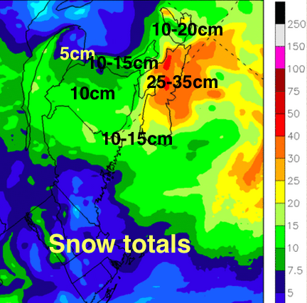
This scenario will result in Nova Scotia receiving the heaviest snowfalls. Environment Canada has issued warnings for much of Nova Scotia and Prince Edward Island.
IMPACTS
Once again transportation will be severely impacted, and you should modify your plans accordingly. Hazardous road conditions and the potential of flight delays or cancellations will result from the combination of strong winds and snow, which will lower visibilities. Ferry travel will likely also be stopped as the storm intensifies on Wednesday.
Conditions will improve in Southwestern New Brunswick by noon Wednesday, then southwestern Nova Scotia in the afternoon. The winds and light snow will however persist into Thursday for Cape Breton and perhaps parts of PEI.
There is yet another low passing south of Nova Scotia on Saturday… so some snow is again expected from that system.
Take care and stay safe