Environment Canada has upgraded to Blizzard warnings; from Winter Storm Warnings. While Winter Storm Warnings advise the public on a hazardous combination of heavy wintry precipitation and damaging winds, a Blizzard Warning indicates the additional dangers related to extended periods of near zero visibilities.
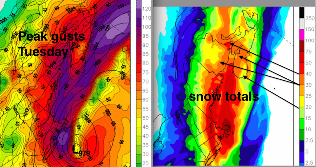
The most recent computer guidance (see picture of peak winds and snow amounts) are consistent with previous guidance. The snow is beginning overnight in southwestern sections of the Maritimes, with extended blizzard conditions through much of the day. The heaviest snow in the Moncton area where east to northeast winds gather additional moisture off of the Gulf of St. Lawrence.
The strongest gusts (in purple on the map) over 100km/h are along the south-facing coasts where additional convergence may increase winds. Strong gusts can also be expected over higher elevations. Prepare for possibility of outages, and remember the weather may make it hazardous for crews to repair power damage, so extended outages are possible.
In Nova Scotia, especially near the Atlantic Coast, a change in precipitation to ice pellets in the afternoon (and maybe even rain) will improve the visibility… but may add to already slippery driving conditions.
Stay Safe


